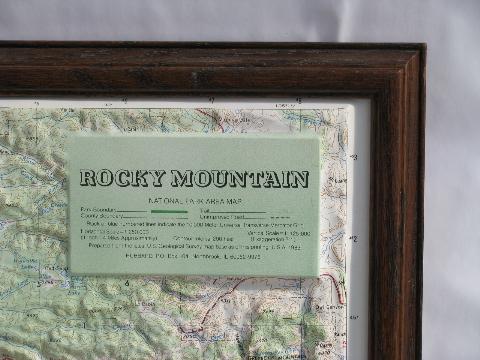
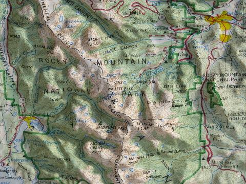
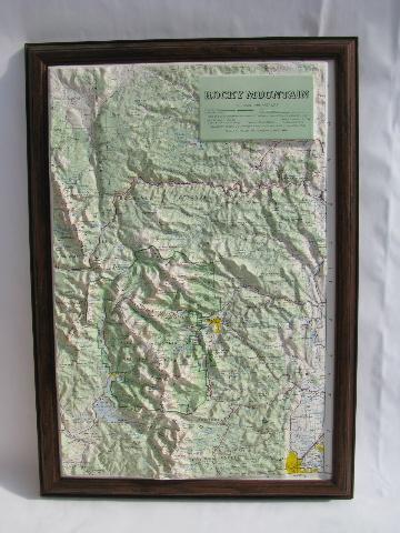
vintage topographical relief map, Rocky Mountain National Park, US Geological Survey
 more photos of this product below
Vintage framed, three dimensional, topographical map of Rocky Mountain National Park and the surrounding area. This is a raised relief map, made of plastic, formed into a terrain model of the ridges, peaks and valleys of the Rocky Mountain Park area. It shows the roads, trails, park boundary, topographical contour lines etc.. The horizontal scale of the map is 1:250,000 (1 inch = 4 miles approximately) and the vertical scale is 1:125,000 (exaggeration 2:1).
The map is constructed from the "latest U.S. Geological Survey map base as of this printing USA 1983". It measures about 11" x 17" over the map and 13 1/2" x 19 1/2" over the frame. There is a hanger on the back of the frame. This is in very nice vintage condition.
- sku: #w4621
- status: sold out